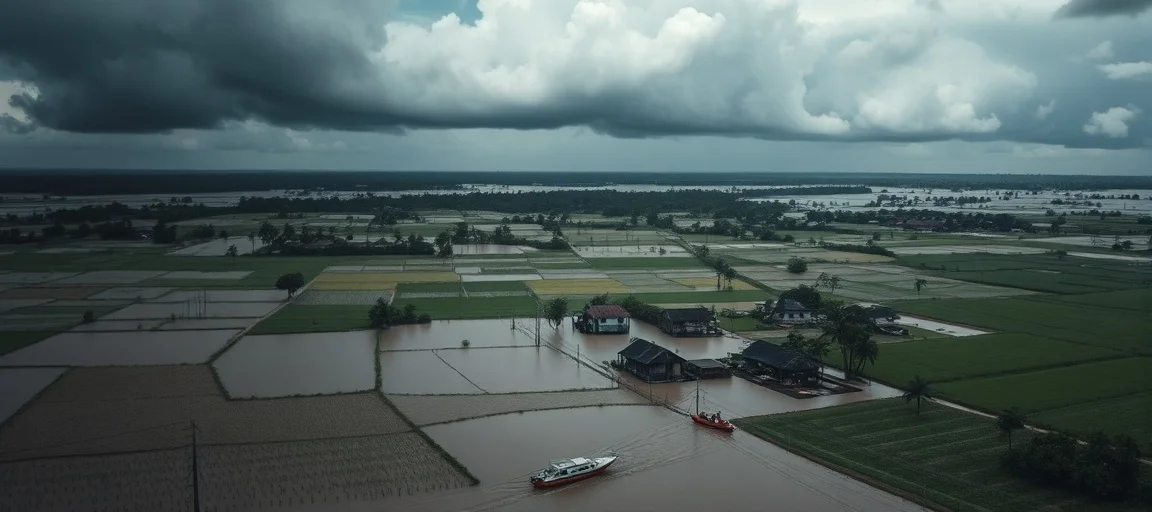
Ganga River Crosses Flood Mark, Threatens Bihar Regions
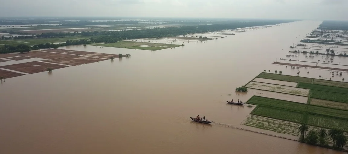
The majestic Ganga River has surged past its danger mark, creating an alarming situation and directly threatening numerous low-lying regions across Bihar. This critical development highlights the persistent challenges faced by the state during the monsoon season, as the escalating water levels necessitate immediate action and heightened vigilance from authorities. The increasing flow from upstream regions, combined with relentless rainfall, has led to a significant rise, putting millions of residents at risk as the Ganga River Crosses Flood Mark, Threatens Bihar Regions. Rapid response teams have been mobilized, and evacuation plans are being activated in vulnerable areas to mitigate potential widespread devastation.
- Rising Waters: The Ganga River Crosses Flood Mark, Threatens Bihar Regions
- Historical Context of Ganga Floods in Bihar
- Government Preparedness and Relief Efforts
- Impact on Livelihoods and Agriculture
- Expert Analysis and Future Outlook
- Conclusion
- Frequently Asked Questions
- Further Reading & Resources
Rising Waters: The Ganga River Crosses Flood Mark, Threatens Bihar Regions
The past week has seen an alarming increase in the water level of the Ganga River, culminating in it breaching the critical flood mark at multiple points along its course through Bihar. This situation is particularly precarious for districts situated along the riverbanks, where communities are now facing the imminent danger of inundation. The continuous discharge from upstream dams and heavy rainfall in the river's catchment areas have contributed significantly to this perilous rise, exacerbating the flood threat that regularly plagues the state during the monsoon season. Local administrations are working tirelessly to monitor the situation, issuing advisories, and preparing for large-scale relief operations.
The Current Situation in Bihar's Districts
Several districts in Bihar are currently on high alert, with water levels exceeding danger thresholds. Patna, Bhagalpur, Begusarai, Munger, and Khagaria are among the most acutely affected regions where the Ganga's swelling waters pose an immediate threat to life and property. In Patna, the capital city, residents living in close proximity to the river are particularly concerned as water inches closer to embankments. Key gauging stations at Gandhi Ghat and Digha Ghat in Patna have reported water levels significantly above the danger mark, triggering widespread apprehension. Similarly, in Bhagalpur, low-lying areas have already begun to experience waterlogging, displacing families and disrupting agricultural activities. The district administrations are working to establish temporary shelters and distribute essential supplies.
The situation is dynamic, with meteorological departments predicting further rainfall in the coming days, which could potentially worsen the flood scenario. Villages nestled along the river's edge, traditionally dependent on the Ganga for their livelihoods, are now bracing for the harsh realities of potential displacement and significant losses. Emergency services, including the National Disaster Response Force (NDRF) and State Disaster Response Force (SDRF) teams, have been strategically deployed across these districts to assist with rescue and evacuation efforts. Their presence aims to provide immediate relief and ensure the safety of residents in areas most vulnerable to the surging river.
Historical Context of Ganga Floods in Bihar
Bihar has a long and often tragic history of recurrent floods, primarily due to its geographical location and the behavior of major river systems like the Ganga and its tributaries. Annually, during the monsoon season (June to September), the state becomes particularly susceptible to flooding as heavy rains swell these rivers, often leading to devastating consequences. The flat topography of the Indo-Gangetic plains in Bihar, coupled with insufficient drainage infrastructure in many areas, makes it highly vulnerable to prolonged waterlogging and inundation. Historical records indicate that severe floods in the Ganga basin have occurred with alarming regularity, impacting millions of lives and causing extensive damage to infrastructure and agriculture. These past events underscore the cyclical nature of the challenge and the need for robust, long-term mitigation strategies.
Monsoon's Role and Geographic Vulnerabilities
The Indian monsoon season is the primary driver of the annual flood cycles in Bihar. Intense rainfall in the upper reaches of the Ganga basin, particularly in states like Uttar Pradesh and Madhya Pradesh, and even in neighboring Nepal, contributes massive volumes of water that eventually flow into Bihar. The state's position downstream means it bears the brunt of accumulated water from a vast catchment area. Furthermore, many rivers like the Kosi, Gandak, Bagmati, and Burhi Gandak, which are major tributaries of the Ganga, originate in the Himalayas. They carry enormous amounts of silt, which over time, raises riverbeds and reduces their carrying capacity, making them more prone to overflowing their banks.
The extensive network of embankments constructed over decades to contain these rivers also presents a complex challenge. While intended to protect land, breaches in these embankments due to high pressure often lead to sudden and catastrophic flooding, trapping communities and causing immense destruction. The flat alluvial plains, which are fertile for agriculture, paradoxically offer little natural resistance to the spread of floodwaters, allowing them to inundate vast areas for extended periods. This combination of heavy monsoon rainfall, a vast river system, and specific geographical features makes Bihar one of the most flood-prone states in India.
Government Preparedness and Relief Efforts
In anticipation of the annual monsoon floods, the Bihar state government, in coordination with central agencies, had initiated a series of preparedness measures. These efforts include pre-positioning relief materials, identifying vulnerable villages, and establishing a network of control rooms to monitor water levels round the clock. Following the breach of the flood mark by the Ganga, these contingency plans have been swiftly activated to address the immediate crisis. The state disaster management authority is working closely with district administrations to ensure a coordinated response. Regular updates are being disseminated through various media channels to keep the public informed about the evolving situation and necessary precautions.
Evacuation Strategies and Relief Camps
One of the most critical aspects of the current response is the large-scale evacuation of residents from low-lying and flood-prone areas. Boat teams, including those from the NDRF and SDRF, are actively engaged in rescuing stranded individuals and transporting them to safer ground. Thousands of people have already been moved from villages situated perilously close to the riverbanks.
The government has established numerous relief camps in higher areas, equipped with essential facilities. These camps provide:
- Shelter: Tents and temporary structures to house displaced families.
- Food: Cooked meals and dry rations to ensure food security.
- Medical Aid: Mobile medical units and doctors to address health concerns and prevent outbreaks of water-borne diseases.
- Sanitation: Temporary toilets and hygiene facilities.
- Drinking Water: Access to safe and clean drinking water to prevent illnesses.
These camps are designed to provide a safe haven and basic necessities for those who have been forced to leave their homes due to the rising waters. Authorities are also focusing on the safety of livestock, assisting farmers in moving their animals to elevated areas.
Long-Term Flood Mitigation Projects
Beyond immediate relief, both state and central governments are engaged in developing and implementing comprehensive long-term flood mitigation strategies to significantly reduce Bihar's perennial vulnerability. These ambitious projects encompass a wide range of engineering and non-engineering interventions, often requiring substantial investment and multi-state cooperation. A significant area of focus is the strengthening and raising of existing embankments, along with the strategic construction of new ones in critical sections identified as prone to breaches. Concurrently, efforts are being intensified to improve natural and artificial drainage systems, which includes the meticulous cleaning and desilting of canals, rivulets, and natural waterways to enhance their carrying capacity. Initiatives like the ongoing Kosi Embankment Project and similar schemes for other major rivers aim not only to contain water but also to better manage overall water flow and prevent catastrophic breaches that have historically devastated communities. The adoption of modern technologies is pivotal: satellite-based early warning systems, real-time monitoring of river levels through advanced sensors, and sophisticated hydrological modeling are increasingly deployed to provide timely alerts. This allows for better preparedness, quicker response times, and optimized reservoir management. Furthermore, the integration of traditional knowledge and local community practices with cutting-edge scientific approaches in flood management is gaining traction, ensuring that solutions are culturally appropriate and locally sustainable. Inter-state cooperation, particularly with upstream states and even Nepal, is recognized as paramount for effective basin-wide water resource management. The long-term goal is to cultivate a more resilient Bihar, capable of withstanding the recurrent and increasingly intense challenges posed by its powerful and dynamic river systems.
Impact on Livelihoods and Agriculture
The incessant rise in the Ganga's water level and the subsequent flooding have already begun to wreak havoc on the livelihoods of millions in Bihar. Agriculture, the backbone of the state's economy, is particularly vulnerable. Farmers, many of whom are small and marginal landholders, face the devastating prospect of losing their entire season's crops. Beyond agriculture, other sectors such as small businesses, daily wage earners, and local trade are also severely impacted as connectivity breaks down and economic activity grinds to a halt. The long-term ripple effects of such widespread disruption can push already vulnerable populations deeper into poverty.
Agricultural Losses and Food Security
Bihar, a state predominantly agrarian in nature, sees a significant portion of its vast population directly dependent on farming for their sustenance and livelihood. The current flooding poses an existential threat to vast tracts of agricultural land, especially fields meticulously sown with staple crops like paddy, maize, and a variety of seasonal vegetables. Many fields have been completely submerged, leading to irreversible damage to standing crops and a total loss for farmers who have invested their season's resources. This catastrophic outcome not only translates to immediate and significant financial losses for individual farmers, pushing many into cycles of debt, but also raises profound concerns about regional food security. A substantial reduction in overall crop yields could precipitate immediate price hikes in local markets and create severe shortages of essential food items, disproportionately affecting the poorest households who rely on daily wages. Beyond the immediate crop destruction, the prolonged waterlogging that often persists after the floodwaters recede can render agricultural land infertile or unsuitable for subsequent planting cycles for extended periods, further exacerbating the economic hardship for entire farming communities. The ripple effect extends to the entire supply chain, from local vendors to larger distributors. Government agencies are diligently preparing comprehensive assessments of crop damage to facilitate timely compensation and support measures for affected farmers; however, the recovery process is invariably lengthy, arduous, and emotionally draining. The destruction of stored grains, essential farming equipment, and the tragic loss of livestock, which are often integral to rural livelihoods and savings, compounds the crisis, presenting a multifaceted challenge to food, economic stability, and the mental well-being of agricultural families.
Disruption to Daily Life and Infrastructure
The impact of the rising Ganga extends far beyond agriculture, severely disrupting the daily lives of millions. Roads and communication networks are among the first casualties of widespread flooding. Numerous roads have become impassable due to waterlogging or damage, isolating villages and hindering rescue and relief operations. This breakdown in connectivity makes it difficult for people to access essential services, including healthcare, and for children to attend schools.
Essential infrastructure, such as power supply lines and drinking water systems, is also vulnerable. Submerged electrical poles and water treatment plants can lead to widespread power outages and contamination of drinking water sources, posing significant public health risks. The displacement of families from their homes, sometimes for weeks or even months, leads to considerable psychological stress and social disruption. The aftermath of floods often sees a rise in water-borne diseases, adding another layer of challenge to the already strained public health system. Restoring normalcy and rebuilding damaged infrastructure will require considerable time, effort, and resources from both government and non-governmental organizations.
Expert Analysis and Future Outlook
Hydrologists and disaster management experts are closely monitoring the situation in Bihar, providing crucial insights into the Ganga's current behavior and potential future trends. The consensus among experts is that the heavy and prolonged monsoon activity, intensified by certain climate patterns, is a significant factor contributing to the elevated river levels. Dr. Rakesh Kumar, a senior hydrologist at a prominent research institution, noted, "The current surge in the Ganga is a direct consequence of an active monsoon trough combined with high discharge from upstream reservoirs. We are seeing sustained high flows, which is concerning for the downstream regions of Bihar."
Forecasts suggest that while peak levels might stabilize in some areas, the river is expected to remain above the danger mark for several days, given the forecast of continued intermittent rainfall. This sustained high level means that communities will face a prolonged period of vulnerability and disruption. Experts emphasize the need for continuous vigilance and proactive measures, especially in maintaining the integrity of embankments. There is also a call for a holistic approach to river basin management, involving cooperation between all states through which the Ganga flows, to address flood control more effectively.
Climate Change and Intensified Monsoon Patterns
A critical dimension often highlighted by experts is the role of climate change in exacerbating flood events. Scientific studies indicate that global warming is leading to more erratic and intense monsoon patterns, characterized by shorter bursts of very heavy rainfall followed by prolonged dry spells. This shift in rainfall distribution contributes to increased runoff and higher flood peaks in river systems.
Dr. Anjali Sharma, a climate scientist, stated, "What we are witnessing in Bihar is consistent with projections for climate change impacts in the Gangetic plains. More extreme weather events, including heavy rainfall, are becoming the new norm. This necessitates not just traditional flood management but also climate-resilient infrastructure and adaptation strategies at the community level." The long-term outlook, therefore, points to the need for Bihar and India as a whole to invest heavily in climate adaptation measures, including nature-based solutions, improved urban drainage, and robust early warning systems, to safeguard its population from increasingly frequent and severe hydro-meteorological hazards.
Conclusion
The current situation in Bihar, where the Ganga River Crosses Flood Mark, Threatens Bihar Regions, underscores the perennial challenge posed by nature's fury during the monsoon season. With water levels remaining critically high, thousands of lives and livelihoods hang in the balance, prompting a massive coordinated effort from disaster response teams and local administrations. While immediate relief and evacuation remain the top priorities, this crisis also serves as a stark reminder of the urgent need for enhanced long-term flood mitigation strategies and climate change adaptation. As communities brace for the full impact of the swollen river, the resilience of Bihar's people will once again be tested, while the authorities continue their tireless efforts to ensure safety and provide support in these challenging times.
Frequently Asked Questions
Q: What is the current status of the Ganga River in Bihar?
A: The Ganga River has crossed its critical flood mark at multiple locations in Bihar due to heavy rainfall and upstream discharge. This poses an immediate threat of inundation to several low-lying districts, requiring active monitoring and emergency responses from authorities.
Q: Which districts in Bihar are most affected by the rising Ganga waters?
A: Districts such as Patna, Bhagalpur, Begusarai, Munger, and Khagaria are currently on high alert. Key gauging stations in these areas report water levels significantly above danger thresholds, leading to widespread concern and the activation of evacuation plans.
Q: What long-term measures are being taken to mitigate floods in Bihar?
A: The government is implementing long-term strategies including strengthening embankments, improving drainage systems, and using advanced early warning technologies. Climate-resilient infrastructure and nature-based solutions are also being explored to address intensified monsoon patterns linked to climate change.