The Historical Evolution of Global Maritime Trade Routes
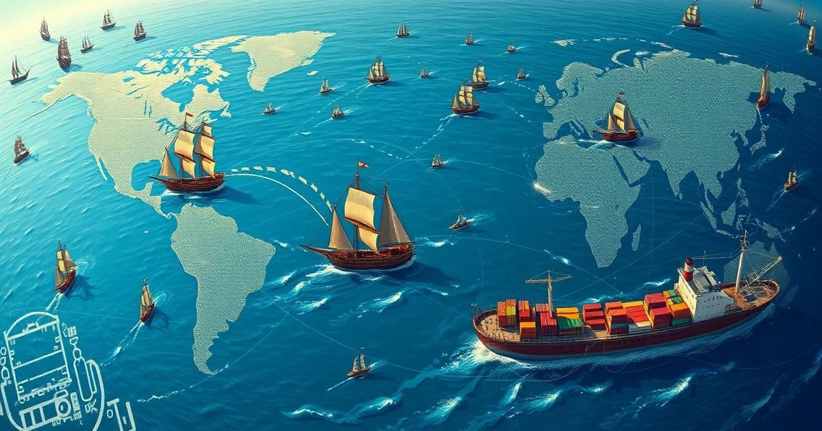
From ancient coastal journeys that hugged familiar shores to the intricate digital networks orchestrating the movement of mega-ships across vast oceans, the historical evolution of global maritime trade routes stands as a testament to humanity's relentless pursuit of connection and commerce. These routes are not merely lines on a map; they are the arteries of global civilization, having shaped empires, facilitated cultural exchange, and driven technological innovation for millennia. Understanding their transformation offers profound insights into geopolitics, economics, and the foundational technologies that underpin our interconnected world.
- Defining the Currents: What Exactly Are Maritime Trade Routes?
- The Dawn of Seafaring: Ancient Routes (Pre-1500 CE)
- The Age of Discovery and Expansion: Globalizing the Oceans (1500-1800 CE)
- Industrial Revolution and the Suez-Panama Era (1800-1950 CE)
- The Containerization Revolution: Modern Efficiency (1950-Present)
- Geopolitical Chokepoints and Strategic Importance
- Technological Tides: Shaping Modern Maritime Trade Routes
- Challenges and the Future Horizon
- Navigating Tomorrow: The Continuous Evolution of Global Maritime Trade Routes
- Frequently Asked Questions
- Further Reading & Resources
Defining the Currents: What Exactly Are Maritime Trade Routes?
At its core, a maritime trade route is a specific path taken by ships to transport goods, people, or information across oceans, seas, and other navigable waterways. These routes are the physical manifestations of global supply chains, connecting production hubs with consumer markets, resource extraction sites with manufacturing centers. Far from being static, they are dynamic entities, constantly adapting to geopolitical shifts, technological breakthroughs, and environmental factors. They are, in essence, the internet's backbone for physical goods, facilitating the massive volume of tangible commerce that flows around the planet.
Imagine a global network of highways, but instead of asphalt, they are made of water, and instead of cars, they are colossal vessels carrying millions of tons of cargo. This intricate system accounts for an astonishing 80% of global trade by volume and over 70% by value, underscoring its irreplaceable role in contemporary society. Without these oceanic lifelines, the modern economy as we know it—characterized by just-in-time delivery, diversified manufacturing, and affordable goods—would simply cease to exist. They are the silent enablers of everyday life, ensuring everything from our morning coffee to our evening electronics makes its way to us.
The Dawn of Seafaring: Ancient Routes (Pre-1500 CE)
The story of maritime trade begins not with grand voyages across open oceans, but with cautious coastal navigation, driven by the immediate needs of emerging civilizations. Early humans, often drawn to fertile river deltas and coastal plains, quickly discovered the efficiency of water transport for goods that were too heavy or bulky to move overland. These initial forays laid the groundwork for the more complex networks that would define the ancient world.
The Mediterranean Cradle: Phoenicians, Greeks, and Romans
The Mediterranean Sea served as the primary crucible for early maritime trade, a relatively calm and interconnected body of water that encouraged seafaring.
- Phoenicians (c. 1500–300 BCE): Hailing from what is now Lebanon, the Phoenicians were arguably the first great maritime traders. They established a vast network of trading posts and colonies across the Mediterranean, reaching as far as the Atlantic coasts of Africa and Europe (even possibly venturing to the British Isles). Their innovative shipbuilding techniques, particularly their robust biremes and triremes, allowed them to carry valuable commodities like purple dye, timber, glass, and metals. Their routes linked the Levant with Egypt, Greece, Italy, and beyond, effectively creating the first pan-Mediterranean economy.
- Greeks (c. 800–300 BCE): Following the Phoenicians, the ancient Greeks expanded on these routes, establishing city-states and colonies throughout the Aegean, Black Sea, and across the Mediterranean. Their trade was vital for securing resources like grain and metals, in exchange for olive oil, wine, and pottery. The geometric precision of their navigation, relying on constellations and landmarks, while basic by modern standards, was revolutionary for its time, allowing for more predictable and efficient voyages.
- Romans (c. 300 BCE–400 CE): The Roman Empire, a land-based power, nonetheless relied heavily on maritime trade to sustain its vast territories. Control of the Mediterranean, which they proudly called Mare Nostrum ("Our Sea"), was paramount. They established sophisticated port cities like Ostia and Alexandria, and their massive grain fleets ensured the sustenance of Rome's burgeoning population. Roman vessels, often larger and sturdier, facilitated the transport of bulk goods like grain, olive oil, wine, and construction materials across an empire that stretched from Britain to North Africa and the Middle East.
The Indian Ocean Network: Monsoons and Spices
Concurrently, and independently, a vibrant and equally significant maritime trade network flourished in the Indian Ocean, predating and often surpassing the Mediterranean in terms of scale and diversity of goods.
- Natural Advantage: This network was uniquely driven by the predictable monsoon winds. Mariners learned to harness these seasonal wind patterns, sailing eastwards from Africa and the Middle East to India and Southeast Asia during one season, and then westwards when the winds reversed. This natural clock dictated the rhythm of trade for centuries.
- Key Commodities: The Indian Ocean trade was famous for its exotic and valuable commodities: spices (pepper, cinnamon, cloves), textiles (cotton, silk), precious stones, incense, and timber. It connected disparate cultures from East Africa, the Arabian Peninsula, India, Sri Lanka, and Southeast Asia (including China via its tributaries).
- Technological Innovations: Local innovations like the lateen sail, adopted widely in the region, allowed for more efficient sailing against adverse winds and in complex coastal waters, further enhancing the network's reach and reliability. The construction of durable dhows and junks, some capable of carrying hundreds of tons, also facilitated this extensive trade. This early globalized network fostered immense cultural exchange, spreading religions, languages, and technologies across vast distances.
The Age of Discovery and Expansion: Globalizing the Oceans (1500-1800 CE)
The late 15th century marked a profound turning point, as European powers, fueled by technological advancements and an insatiable desire for new trade routes and resources, embarked on ambitious voyages that would irrevocably connect the world's oceans. This era fundamentally redrew the map of global maritime trade.
Breaking the Boundaries: Columbus, Da Gama, and Magellan
- Vasco da Gama (1498): The Portuguese explorer's successful circumnavigation of Africa to reach India directly by sea was a monumental achievement. It bypassed the traditional overland Silk Road and the Venetian-controlled spice trade routes in the Mediterranean, opening a direct maritime link between Europe and Asia. This instantly shifted the balance of power, diminishing the importance of Venice and the Ottoman Empire in the lucrative spice trade.
- Christopher Columbus (1492): While not reaching Asia as intended, Columbus's voyages across the Atlantic inadvertently discovered the Americas, initiating what would become the Trans-Atlantic trade network. This discovery catalyzed the 'Columbian Exchange,' a vast transfer of plants, animals, culture, human populations, technology, diseases, and ideas between the Americas, West Africa, and the Old World in the 15th and 16th centuries.
- Ferdinand Magellan (1519-1522): Though Magellan himself died en route, his expedition completed the first circumnavigation of the Earth, definitively proving that all oceans were connected. This opened up the Pacific as a potential, albeit long and hazardous, trade route.
The Atlantic Triangle and Pacific Silver Routes
These voyages led to the establishment of entirely new, globally significant trade routes:
- The Atlantic Triangle Trade: This infamous network linked Europe, Africa, and the Americas. European manufactured goods (textiles, rum, weapons) were traded for enslaved Africans, who were then forcibly transported across the Atlantic to the Americas. In the Americas, enslaved labor produced raw materials like sugar, tobacco, and cotton, which were shipped back to Europe. This brutal system was a cornerstone of colonial economies for centuries.
- The Manila Galleon Trade (1565-1815): Connecting Spanish colonial Manila in the Philippines with Acapulco in Mexico, this was the first truly trans-Pacific trade route. Spanish galleons carried vast quantities of silver mined in South America (mainly Potosí) to Asia to purchase luxury goods like silk, porcelain, and spices, which were then transported back to Europe via Mexico and the Atlantic. This route effectively created the first continuous global supply chain, linking the economies of Asia, the Americas, and Europe.
Naval Power and Route Control
The Age of Discovery saw the rise of powerful European naval empires (Portugal, Spain, Netherlands, Britain, France). Control over key maritime routes became synonymous with geopolitical dominance. Naval superiority was essential not only for exploration but also for protecting merchant fleets, establishing colonies, and projecting power. Fortified trading posts and naval bases were strategically positioned along these routes, securing access and enforcing monopolies. The competition for these routes often led to fierce naval battles and colonial wars, fundamentally shaping international relations.
Industrial Revolution and the Suez-Panama Era (1800-1950 CE)
The 19th century ushered in the Industrial Revolution, a period of unprecedented technological innovation that profoundly reshaped global manufacturing, demand, and, consequently, maritime trade. The advent of steam power and the monumental construction of interoceanic canals drastically reduced transit times and costs, effectively shrinking the world.
The Steamship Revolution
Before steam, sailing ships were at the mercy of the wind, making voyages long, unpredictable, and often dangerous.
- Reliability and Speed: The development of practical steam engines for ships in the early 19th century was a game-changer. Steamships could maintain consistent speeds regardless of wind conditions, navigate against currents, and adhere to schedules. This predictability was invaluable for burgeoning industrial economies demanding reliable delivery of raw materials and finished goods.
- Increased Capacity and Specialization: Early steamships were often hybrid sail-and-steam, but as engine technology improved, dedicated steamships became dominant. They could be larger, carry more cargo, and travel faster. This era also saw the emergence of specialized vessels, such as refrigerated ships (reefers) for transporting perishable goods, oil tankers, and bulk carriers, catering to the specific needs of industrial production and mass consumption. The Great Eastern, launched in 1858, was an engineering marvel, designed to carry thousands of passengers and vast amounts of cargo, foreshadowing the scale of future maritime transport.
The Interoceanic Canals: Suez and Panama
While steamships offered speed, geographical barriers still necessitated long detours. The construction of the Suez and Panama Canals represented monumental feats of engineering that fundamentally re-engineered global geography for trade.
- Suez Canal (Opened 1869): Connecting the Mediterranean Sea to the Red Sea, the Suez Canal eliminated the arduous and time-consuming voyage around Africa (the Cape of Good Hope route) for trade between Europe and Asia. It slashed travel distances by thousands of miles (e.g., London to Mumbai reduced by approximately 4,500 nautical miles), dramatically cutting transit times and fuel costs. This canal became a vital strategic asset, particularly for the British Empire, strengthening its links to India and its vast colonial holdings. Its impact was immediate and transformative, solidifying new trade patterns and reinforcing European dominance in global commerce.
- Panama Canal (Opened 1914): Spanning the Isthmus of Panama, this canal linked the Atlantic and Pacific Oceans, allowing ships to avoid the treacherous and lengthy journey around the southern tip of South America (Cape Horn). For routes between the East Coast of the Americas and the West Coast, or between Europe and Asia via the Americas, the Panama Canal drastically reduced distances (e.g., New York to San Francisco reduced by around 8,000 nautical miles). It facilitated the growth of trade across the Pacific and had a profound impact on US naval power and commercial influence.
These canals acted as global shortcuts, intensifying trade flows, accelerating globalization, and significantly influencing geopolitical strategies, as control over them became critical for national and economic security.
World Wars and Maritime Routes
The two World Wars (1914-1918 and 1939-1945) dramatically impacted global maritime trade routes.
- Disruption and Blockades: Naval warfare, particularly submarine warfare, severely disrupted established routes. Convoys were introduced to protect merchant shipping, and vital sea lanes became battlegrounds.
- Strategic Importance: The wars underscored the absolute strategic importance of maritime trade for wartime logistics, supplying troops and maintaining civilian economies. The Battle of the Atlantic, for instance, was a struggle for control of the supply lines that kept Britain and the Soviet Union alive.
- Post-War Reshaping: After each conflict, routes had to be re-established, and new geopolitical realities influenced shipping lanes, leading to the rise of new maritime powers and the decline of others.
The Containerization Revolution: Modern Efficiency (1950-Present)
While steamships and canals transformed how and where goods traveled, the mid-20th century witnessed an innovation that fundamentally reshaped how goods were handled at ports and throughout the supply chain: containerization. This seemingly simple invention had an impact comparable to that of the internet on information exchange, creating a seamless, interconnected global logistics system.
Malcolm McLean and the Box that Changed the World
The genesis of containerization is often attributed to American trucking magnate Malcolm McLean. Frustrated by the inefficiencies of traditional cargo loading (break-bulk cargo, where individual boxes, sacks, and barrels were manually loaded and unloaded), McLean envisioned a standardized metal box that could be seamlessly transferred between trucks, trains, and ships.
- The Ideal X (1956): On April 26, 1956, McLean's converted tanker, the Ideal X, sailed from Newark, New Jersey, to Houston, Texas, carrying 58 truck trailers, marking the birth of container shipping. The innovation wasn't just the box itself, but the entire system built around it.
- Standardization: The International Organization for Standardization (ISO) quickly adopted standards for container dimensions (e.g., 20-foot and 40-foot equivalent units, TEU and FEU). This standardization was crucial, enabling containers to be used interchangeably across different transport modes and by different companies worldwide.
Impact on Logistics, Speed, and Cost
The container changed everything:
- Massive Cost Reduction: Before containers, loading a ship could take days or even weeks, requiring thousands of longshoremen. Containerization reduced loading/unloading times to hours, dramatically cutting labor costs and port dwell times. This directly translated into lower shipping costs per unit of cargo, making global trade far more economical.
- Increased Speed and Efficiency: Faster turnaround times in ports meant ships spent more time at sea, increasing the overall speed of goods movement. The seamless transfer between modes (ship-to-rail, ship-to-truck) eliminated bottlenecks and significantly streamlined the entire supply chain.
- Reduced Theft and Damage: Sealed containers offered better protection against theft and damage compared to individual loose cargo, reducing insurance costs and improving reliability.
- Rise of Mega-Ships and Hub Ports: The efficiency gains of containers incentivized the construction of ever-larger container ships (ultra large container vessels, ULCVs), capable of carrying tens of thousands of TEUs. This in turn spurred the development of mega-ports with specialized gantry cranes and vast stacking yards to handle the enormous volumes. Hub-and-spoke networks emerged, where mega-ships connect major hub ports, and smaller feeder vessels distribute cargo to regional ports.
Digitalization and the Modern Maritime Ecosystem
Containerization provided the physical framework, but digital technologies are the nervous system of modern maritime trade.
- GPS and AIS: Global Positioning Systems (GPS) provide pinpoint accuracy for navigation, while the Automatic Identification System (AIS) allows vessels to broadcast their position, course, and speed, enabling real-time tracking and collision avoidance.
- Port Management Systems: Sophisticated software orchestrates the movement of containers within ports, optimizing crane operations, yard management, and truck scheduling.
- Supply Chain Management Software: Advanced platforms use data analytics, AI, and IoT to track every container from origin to destination, providing transparency, predicting delays, and optimizing routes. Blockchain technology is also being explored to enhance security, transparency, and traceability in logistics documentation. This digital layer has transformed maritime shipping into a highly precise, data-driven operation, far removed from the unpredictability of earlier eras.
Geopolitical Chokepoints and Strategic Importance
While technological advancements have optimized maritime trade, certain geographical features remain immutable and critically important: chokepoints. These narrow straits or canals are vital arteries of global commerce, and their vulnerability has profound geopolitical implications. Disruptions at these points can send ripple effects throughout the global economy.
- Strait of Hormuz: The sole sea passage from the Persian Gulf to the open ocean, it is arguably the world's most critical oil chokepoint. Approximately 20% of the world's total petroleum liquids consumption, and a third of all seaborne traded oil, passes through this 21-mile wide strait. Political instability in the region, particularly involving Iran, frequently raises concerns about its security.
- Strait of Malacca: This narrow waterway between the Malay Peninsula and the Indonesian island of Sumatra is one of the busiest shipping lanes in the world. It serves as the main conduit for trade between Asia and Europe/Middle East, with an estimated one-quarter of the world's traded goods, including a significant portion of East Asian energy supplies, transiting through it. Piracy and potential closures due to conflict remain constant concerns.
- Bab-el-Mandeb Strait: Located between Yemen on the Arabian Peninsula and Djibouti and Eritrea in the Horn of Africa, this strait connects the Red Sea to the Gulf of Aden and the Indian Ocean. It is a critical gateway for vessels traveling to and from the Suez Canal, carrying oil, natural gas, and general cargo. Recent attacks by Houthi rebels have highlighted its extreme vulnerability, forcing many shipping companies to reroute around Africa, a topic often discussed in analyses of the Mideast Conflict.
- Suez Canal and Panama Canal: As discussed, these man-made canals are chokepoints of immense strategic value. Blockages, such as the 2021 grounding of the Ever Given in the Suez Canal, or security threats, demonstrate their fragility and the cascading economic impact of their disruption.
These chokepoints are analogous to critical nodes in a digital network; a failure at one can cause widespread outages. Consequently, naval powers dedicate significant resources to ensuring their security and freedom of navigation, making them focal points of international diplomacy and potential conflict. The security of global maritime trade routes is intrinsically linked to global stability and power dynamics.
Technological Tides: Shaping Modern Maritime Trade Routes
The relentless pace of technological progress continues to redefine the historical evolution of global maritime trade routes, pushing boundaries of efficiency, safety, and sustainability. From advanced navigation to autonomous vessels, the future of shipping is increasingly digitized and data-driven.
Advanced Navigation Systems
Modern navigation has moved light-years beyond celestial observations and paper charts.
- Global Navigation Satellite Systems (GNSS): GPS (US), GLONASS (Russia), Galileo (EU), and BeiDou (China) provide highly accurate positioning data, enabling precise route planning and execution, minimizing fuel consumption, and enhancing safety.
- Electronic Chart Display and Information Systems (ECDIS): These digital charting systems integrate GNSS data with real-time navigational information, eliminating reliance on paper charts and providing dynamic overlays of weather, traffic, and hazards. They significantly improve situational awareness.
- Autonomous Vessels: The concept of unmanned or remotely operated ships is rapidly progressing. AI-powered navigation systems, sensor fusion (radar, lidar, cameras), and advanced control algorithms are being developed to allow ships to operate with minimal human intervention, promising further reductions in operating costs and potentially improved safety by eliminating human error. Projects like Rolls-Royce's "intelligent awareness" systems are at the forefront of this transformation.
Logistics & Data Analytics
The vast amounts of data generated by global shipping are being harnessed to optimize every aspect of the supply chain.
- Internet of Things (IoT): Sensors on containers, ships, and port infrastructure collect real-time data on cargo conditions (temperature, humidity), vessel performance, and port congestion. This data feeds into analytics platforms for predictive maintenance and operational efficiency.
- Artificial Intelligence (AI) and Machine Learning (ML): AI algorithms analyze historical and real-time data to optimize routes for weather, fuel efficiency, and port congestion; predict demand fluctuations; and automate aspects of freight management. For example, AI can suggest optimal sailing speeds to arrive "just-in-time" to avoid port waiting fees.
- Blockchain: This distributed ledger technology is being explored to create immutable and transparent records of cargo movements, documentation, and payments. It can reduce fraud, streamline customs processes, and enhance traceability throughout complex supply chains.
Ship Design & Propulsion
Innovation in vessel design and propulsion is driven by twin goals: greater capacity and environmental sustainability.
- Ultra Large Container Vessels (ULCVs): The continuous increase in ship size (some ULCVs now exceed 24,000 TEUs) reflects the pursuit of economies of scale, reducing the cost per container. This trend, however, also places pressure on port infrastructure and canal capacities.
- Alternative Fuels: To meet increasingly stringent environmental regulations and decarbonization targets, the industry is actively exploring and investing in alternative propulsion technologies.
- LNG (Liquefied Natural Gas): A transitional fuel, LNG significantly reduces sulfur oxides (SOx), nitrogen oxides (NOx), and particulate matter emissions compared to heavy fuel oil.
- Methanol, Ammonia, Hydrogen: These fuels offer pathways to near-zero carbon emissions, though they present challenges related to storage, safety, and production scalability.
- Wind-Assisted Propulsion (WAP): Modern sails or rotor systems are being reintroduced to supplement engine power, particularly on bulk carriers and tankers, leveraging centuries-old technology with modern engineering for fuel efficiency.
Port Infrastructure
Ports are transforming into highly automated, interconnected logistics hubs.
- Automation: Automated guided vehicles (AGVs) move containers within terminals, automated stacking cranes (ASCs) manage container yards, and robotic systems assist with loading and unloading. This significantly boosts efficiency, reduces labor costs, and improves safety.
- Smart Ports: Integrated digital platforms connect all stakeholders—vessels, terminal operators, customs, freight forwarders, and logistics providers—enabling seamless data exchange, predictive analytics for vessel arrivals, and optimized resource allocation. This creates a highly efficient, synchronized ecosystem, effectively making the port a digital nerve center for global trade.
Challenges and the Future Horizon
The trajectory of maritime trade is not without its challenges. As the world becomes more interconnected, so too do the vulnerabilities and complexities of its foundational transport system.
Climate Change and Arctic Routes
Global warming presents both threats and potential new opportunities for maritime trade.
- Arctic Melt: The melting of Arctic ice opens up new shipping lanes, most notably the Northern Sea Route (NSR) along Russia's Arctic coast and the Northwest Passage through the Canadian Arctic Archipelago. These routes significantly shorten transit times between Asia and Europe, potentially reducing distances by up to 40% compared to the Suez Canal.
- Challenges: The Arctic remains a harsh environment with unpredictable ice conditions, limited infrastructure (search and rescue, refueling), and significant environmental risks (oil spills, impact on delicate ecosystems). Geopolitical competition for control and access to these routes is also intensifying.
- Sea Level Rise and Extreme Weather: Conversely, rising sea levels threaten coastal port infrastructure, and increased frequency and intensity of extreme weather events (hurricanes, typhoons) disrupt shipping schedules, pose navigational hazards, and damage vessels and cargo.
Geopolitical Shifts and New Trade Dynamics
The global political landscape constantly influences maritime trade.
- Belt and Road Initiative (BRI): China's massive infrastructure project includes a significant "Maritime Silk Road" component, investing in port infrastructure and shipping lanes across Asia, Africa, and Europe. This initiative aims to enhance connectivity and trade flows, potentially reshaping existing maritime networks and creating new geopolitical spheres of influence.
- Trade Wars and Protectionism: Rising protectionist sentiments and trade disputes can lead to shifts in sourcing, tariffs, and retaliatory measures that disrupt established shipping patterns and encourage regionalization of supply chains.
- Regional Blocs and Alliances: The formation of new economic blocs or security alliances can lead to preferential trade agreements, joint infrastructure projects, and coordinated naval operations that impact the efficiency and security of specific maritime routes.
Cybersecurity Threats
As maritime operations become increasingly digitized and interconnected, they become prime targets for cyberattacks.
- Vulnerability: Navigation systems, port operations, logistics platforms, and even ship engines are susceptible to cyber threats. A successful attack could disrupt port operations, reroute ships, compromise cargo, or even disable a vessel at sea, with potentially catastrophic economic and safety implications.
- Mitigation: The industry is increasingly focused on developing robust cybersecurity protocols, investing in threat detection and response systems, and training personnel to counter these evolving risks.
Automation and Job Displacement
While automation in ports and potentially on ships promises greater efficiency, it also raises concerns about job displacement for longshoremen, crane operators, and even seafarers. The industry faces the challenge of managing this transition equitably and investing in reskilling programs.
Sustainability and Decarbonization
The environmental footprint of shipping is immense, contributing significantly to global greenhouse gas emissions and air/water pollution.
- IMO 2020: The International Maritime Organization's sulfur cap (IMO 2020) reduced the permissible sulfur content in marine fuel, leading to cleaner air.
- Decarbonization Targets: The industry is under pressure to meet ambitious decarbonization targets, with a goal of achieving net-zero emissions by around 2050. This requires massive investment in research and development of zero-emission fuels, energy-efficient ship designs, and operational optimization.
Navigating Tomorrow: The Continuous Evolution of Global Maritime Trade Routes
From the primitive rafts traversing ancient rivers to the AI-driven behemoths charting courses across digitized oceans, the journey of the historical evolution of global maritime trade routes is a vivid narrative of human ingenuity and geopolitical ambition. It underscores a fundamental truth: as long as humanity produces, consumes, and connects, the seas will remain its indispensable highways. Each era has brought its own set of challenges and transformative technologies, from the lateen sail to the container and now to autonomy and alternative fuels.
Looking ahead, these routes will continue to be shaped by a complex interplay of technological innovation, environmental imperatives, and the ever-shifting currents of geopolitics. The drive for sustainability, the allure of Arctic shortcuts, and the persistent vulnerability of critical chokepoints ensure that the story of maritime trade is far from over. It is a dynamic, living system, constantly adapting, reminding us that true global connectivity relies on both cutting-edge technology and a profound respect for the enduring power of the world's oceans. The future of global commerce will, undoubtedly, continue to ride the waves.
Frequently Asked Questions
Q: Why are maritime trade routes so crucial to the global economy?
A: Maritime trade routes are the backbone of global commerce, transporting over 80% of goods by volume. They facilitate supply chains, connect production with consumption, and underpin the modern economy's efficiency and affordability.
Q: How did the Suez and Panama Canals revolutionize global shipping?
A: These interoceanic canals dramatically shortened travel distances and times for trade between continents. They reduced operational costs, enabling faster, more predictable global movement of goods and profoundly reshaping trade patterns.
Q: What is containerization and what was its impact on trade?
A: Containerization introduced standardized metal boxes for cargo, revolutionizing logistics. It drastically cut loading/unloading times, reduced costs, minimized theft/damage, and enabled the efficient, intermodal transport of goods worldwide.